24 YEAR FLASHBACK: DIRT FLIES AT CALHOUN'S FIRST DEEP WELL - What It Meant To The Economy Was Zip
By Bob Weaver 2001
Ground has been broken for Calhoun's first real deep well. The site is at the head of Bull River close to White Pine Road, near the Ray Yoak and Coleman Burrows property.
Originally is was referred to as "the old Spoon place," owned more recently by Elias Yoak.
Trio Petroleum, owned by Ike Morris of Glenville, is reportedly in a joint venture with the Cabot Corporation on the multi-million dollar hole, which will be drilled directly below one of Calhoun's highest points, Kight Knob.
At least 22 deep well permits have been issued for Calhoun. Grading began this week on the Yoak heirs property, within eyesight of the secondary road.
Sources said the well could slant under other royalty interests in the area.
Geological surveys are being done one more time along most of the counties primary and secondary roads, noted by small blaze orange flags and miles of cable.
Much of the county was studied last year for deep well pockets by mobile "thumpers" which send signals deep into the earth. The Clerk's office in Grantsville has been filled with title researchers for months.
Calhoun was the site for the original deep well in the area, the hole put down between Mount Zion and Pine Creek in the early 1970's, the companies declaring it a dry hole, widely disputed by locals. It was plugged.
Exactly what big producing wells will mean to Calhoun is unclear, particularly as it relates to helping the struggling counties tax base.
Producers of Roane Counties deep wells say Columbia is reporting 8,000,000 (million) cubic feet of production a day, which translates to $88,000 in daily sales at $11 per thousand. Four of Columbia's wells are producing in Roane. They have been phenomenal producers.
(That production ended in the largest civil lawsuit in the state of West Virginia, the royalty owners saying they were cheated. They won.)

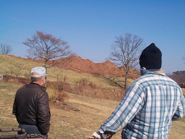
Top soil moved to side, Coleman Burrows (left)

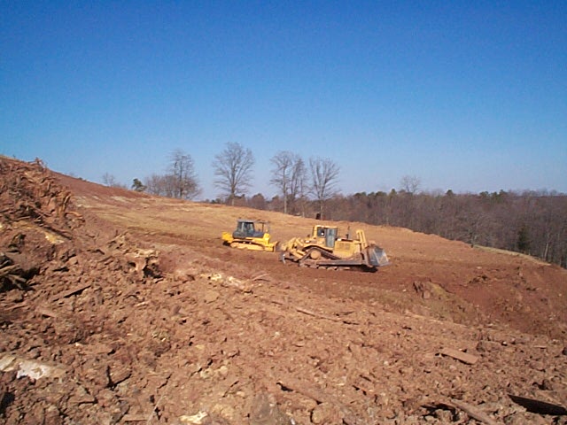
County's first deep well site

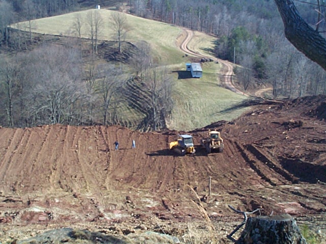
Deep well site close to Bull River - White Pine Road

County is being studied, one more time

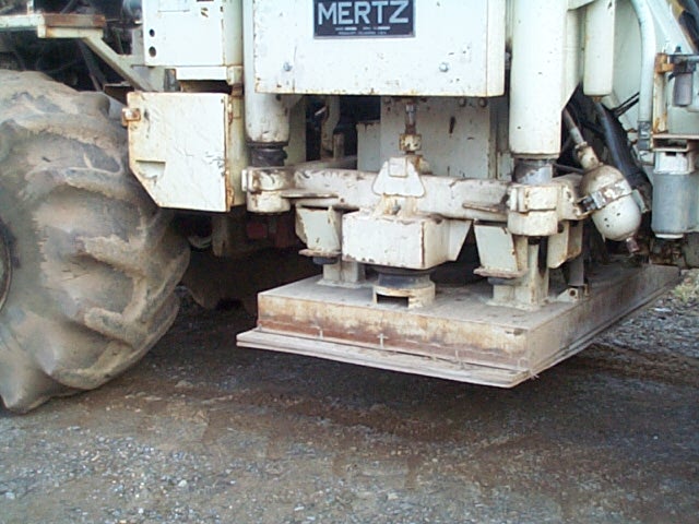
"Thumper" sends signals through earth defining locations for drilling

Source: WV Geological Survey
Map from the Charleston Gazette
ALVIN ENGLEKE (7/7/2000) Royalty rights to 56 acres in Lee District, Beech Fork; well operator, David and Garnet Barr.
J. J. STARCHER HEIRS (9/29/2000) Royalty rights to 25 acres in Lee District, Daniels Run; well operator, Ardent Resources.
IMOGENE HAYMAKER/OTHERS (9/29/2000) Royalty rights to 84 acres in Lee District, Arnoldsburg area; well operator, Ardent Resources.
BERNARD HAYS GROUP (9/5/2000) Royalty rights to 398 acres (surface John S. Stump) in Lee District, Arnoldsburg; well operator, McIntosh Partners.
MORRIS OIL AND GAS (9/11/2000) Royalty rights to 58 acres (surface Roberto Lupez) in Sherman District; well operator Ardent Resources.
CAROLYN DOELLING (9/25/00) Royalty rights to 32 acres (surface Rickey Sampson) Sherman District; well operator Trio Petroleum, Glenville.
MARY A. WALLEYE (9/25/00) Royalty rights to 50 acres (surface Ralph Cunningham); well operator, Trio Petroleum, Glenville.
DENZIL G. WARD (9/19/2000) Royalty rights to 88 acres on Laurel, Sherman District; well operator, Trio Petroleum, Glenville.
MICHAEL WHIPKEY (9/22/2000) Royalty rights on 32 acres (surface Craig Church) Tributary of Laurel, Sherman District; well operator Trio Petroleum, Glenville.
W. BARL JOHNSON (8/24/2000) Royalty on 84 acres (surface James Morris) in Sherman District; well operator, Trio Petroleum, Glenville.
CABOT OIL AND GAS (8/30/2000) Royalty on 249 acres (surface R. J. M. Trust, Richard Morris) Sherman District; well operator Trio Petroleum, Glenville.
CABOT OIL AND GAS (8/26/2000) Royalty on 249 acres (surface Eva Marie Ball) in Sherman District; well operator Trio Petroleum, Glenville.
FRED WEBB (9/25/2000) Royalty on 78 acres (surface Orville Ray Yoak) in Sherman; well operator Trio Petroleum, Glenville.
IMOGENE HAYMAKER AND OTHERS (9/6/2000) Royalty on 235 acres in Lee District, Arnoldsburg; well operator McIntosh Partners.
WALTER E. SMITH (9/22/2000) Royalty on 25 acres in Sherman District; well operator Walter E. Smith.
MARIE BALL/BETHLEHEM BAPTIST CHURCH (8/30/00) Royalty on 101 acres (surface John Ball) on Bull River/Sherman District; well operator, Ardent Resources.
GEORGE JOHNSON (8/31/2000) Royalty on 101 acres on Bull River/Sherman District (surface H & R Pipeline); well operator, Ardent Resources.
LOVIE LAUGHLIN (8/21/2000) Royalty on 85 acres (surface Lee McKown) Tributary of Road Road, Lee District.
R. PLANT HEIRS (9/6/2000) Royalty on 53 acres (surface Jim Morris) in Sherman District; well operator Creston Oil Company.
GORDON/EVADEEN KESLER (8/17/2000) Royalty on 40 acres on Big Run, Sherman District; well operator Trio Petroleum.
LEWIS SMITH HEIRS (7/14/2000) Royalty on 49 acres on Road Run of Beech Fork (Thomas McLaughlin surface); well operator Ardent Resources.
LYNN GILBERT (5/9/2000) Royalty on 42 acres on Sauls Run of Road Road; well operator Columbia Natural Resources.